Beaches are not only the greatest source of recreation for Australians but are one of the greatest generators of sustainable income into the future.
A little-known Western Australian beach called Misery has taken out the title of Australia’s Best Beach.
Described as ‘picture perfect’, Misery Beach, near Albany in WA, is one of 20 beaches judged to be the country’s best for 2022 by Australian coastal veteran and Tourism Australia appointed Friend of Australia and beach expert, Brad Farmer AM. Farmer has been writing about beaches for almost 40 years and has visited most of Australia’s accessible beaches in his research travels.
This year’s list is compelling, with their unique cultural connection to First Nations Country and some truly outstanding beaches not often found in internet searches. Every state and territory are included in this year’s list, including Christmas Island (Indian Ocean Territories) and K’Gari (formerly named Fraser Island), Mots Beach at the mouth of the Snowy River, and Murrays Beach in Jervis Bay Territory.
Australia has the largest number of beaches of any country in the world with close to 12,000 beaches. Our coastal culture helps define our national identity and remains our main tourism drawcard, domestically and internationally.
Top 20 Best Beaches in Australia 2022
MISERY BEACH
Location: Albany, Western Australia | Google Map
Crystal clear, turquoise water, virgin white sand, bounded by spectacular granite outcrops, Misery Beach belies its grim name. It is Australia’s last active whaling station nearby closed in 1978 and its historical past of slaughtering the giant sperm whale now seems a distant memory. For decades, this shoreline was often awash white whale offal, staining the beach with its red blood. These days, you’ll find only a handful of beachcombers, swimmers, or kayakers enjoying themselves of its sublime surroundings.
Home of the Menang Noongar First Nations people, this is a pristine beach deserving of cultural reverence. Five hours southeast from Perth, yet only 15-minutes from WA’s historic first European settlement Albany, this 200-meter wide bay welcomes seals, dolphins, and returning migratory whales, seeking its calm shelter. Neighboring Isthmus Hill, a former whale lookout point, provides spectacular views of the surrounding coast, which is well worth exploring for other glistening treasures in this truly special region.
HORSESHOE BAY
Location: South West Rocks, NSW | Google Map
Part of the Dhanggati Country, this fine specimen is horseshoe-shaped and a course favorite on the mid-north of NSW. Surrounded by towering Norfolk Pines, with idyllic picnic spots and holiday cabins, it’s just a casual stroll from the quaint coastal village of South West Rocks. North-facing Horseshoe Bay is only 150m in length, patrolled during peak seasons, and is the popular village beach of this holiday and fishing hub of 3500 salty locals. Midway between Coffs Harbour and Port Macquarie, the region was better known in history for its goal build in 1886 at nearby Trial Bay, neighboring the amazing Arakoon National Park. There are rainforest walks, mountains to climb, and many more great beaches here within a short drive. Surfboards, SUP’s and fishing gear are essentials to pack or golf clubs for the 4-star SWR Country Club. Horseshoe Bay features a grassy, naturally sloping amphitheater to enjoy. You could not find a finer place to relish a quintessential Aussie beach experience from sunrise to sundown.
THE SPIT
Location: Gold Coast, QLD | Google Map
Every major city has one, breathing space and escape destination amid the hustle and bustle of life in a hectic metropolis. From New York’s Central Park to The Spit at the northern end of the Gold Coast, every city needs its green lungs and recreational open space to seek peace within nature. Away from the intensely developed concreted city spine, here soft walking trails through low vegetation led to a frequently uncrowded, 4km stretch of beach, backing onto the tranquil Broadwater, on its immediate western shoreline. The Spit is reserved for quiet bushwalks or surfside reflections – with less crowded surfing conditions than the more iconic National Surfing Reserve pointbreaks to the south. The Seaway Promenade at the Top of The Spit provides a wide, 670-meter-long accessible pathway, enabling visitors to reach the eastern end of the southern Seaway wall with its spectacular views of the Gold Coast skyline. Whether it’s walking your dog, getting wet, or launching your boat in the Broadwater, The Spit really has something for everyone. There are a few rips so be cautious, but it’s relatively safe to swim and patrolled from November to April. For the more adventurous there’s snorkeling, scuba diving or higher-level surfing, across at TOS (The Other Side) on South Stradbroke Island (South Straddie). The Southport Spit is a national treasure to be preserved for future generations.
FLAHERTY'S BEACH
Location: South Australia | Google Map
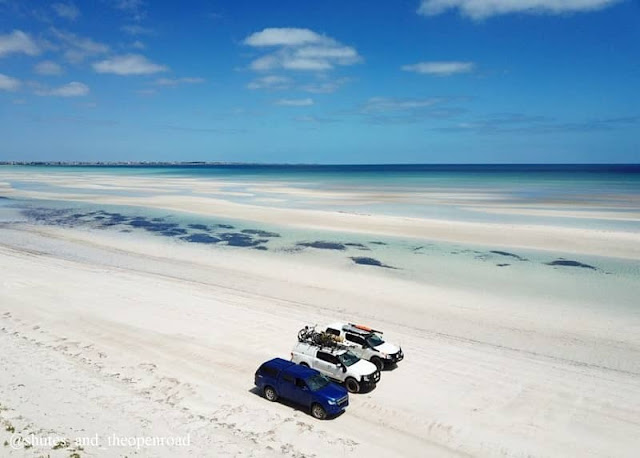
South Australia’s many fine beaches have often been undervalued and overlooked, but the locals don’t seem to mind a bit. Flaherty’s Beach (a 3-hours drive from Adelaide on the west coast of the Yorke Peninsula), is a striking case in point. Featuring dazzling turquoise waters and white sand reminiscent of the Maldives, it can be reached by a four-wheel-drive or a short walk from a handy car park. Its myriad shallow tidal sandbars are ideal for lounging in the crystal waters on long summer days, and the generously wide beach is beloved by beachcombers and four-wheel drivers alike. The safe undulating shallows can stretch some 800m into clear waist-deep waters, and the beach is dog-friendly. Nearby Point Turton offers cabins and shacks for rent along with a tavern and general store. Here you can buy bait and that’s as much of a hint as the locals will provide to what bounty marine-rich waters can offer.
LOCH ARD GORGE
Location: Port Campbell, Victoria | Google Map
Laying on the golden sands of this secluded beach, hemmed in by towering limestone cliffs, you could be forgiven for imagining you were on a film set or shipwrecked on some distant shore. This beach of otherworldly feel has been the scene of both and is one of the great tourism drawcards along the iconic Great Ocean Road. Loch Ard Gorge is a tear-shaped inlet encircled by ancient 30m high cliffs carved out over millennia by the mighty energy of the Southern Ocean. This 100m lay of fine southern sand is reached by seven flights of around 100 steps and is one of the few patches of beach on this stretch of the Great Ocean Road able to be reached from the carparks above. Tucked deep beneath the towering coast within the Port Campbell National Park, this is one of Australia’s most spectacular and alluring beaches, an enchanting sandy chasm enclosed in a natural Amphitheatre of ochre-hued and blue-jeweled water. The raging sea bursting through the narrow opening is a sight to behold, but its wild waves, steep drop off and cold water make it unsafe for swimming. Nearby Port Campbell, under three hours drive from Melbourne, offers a great patrolled beach.
THE NECK
Location: Bruny Island, Tasmania | Google Map
Bruny Island keeps popping up on the best Australian beaches radar, for good reason. Of our 8,222 islands, this island off an island is a Tassie treasure offering beautiful beach escapes and compelling insight into Indigenous and Early European convict history. Similar to the size of Singapore with a population of around 1000, Bruny Island has in fact 94 varied beaches. Only 40m from Hobart, the passenger and vehicle ferry from Kettering quickly transports you to another world of timeless natural beauty. The Neck is a 7km isthmus, a stretch of sand that connects North and South Bruny Islands, and the stunning view it provides is a social media favorite. To embrace the full beauty of the island it’s best to climb the 238 timber steps from the dunal carpark up to Truganini lookout for a 360-degree vista. The signage tells the sobering story of the Nuenonne people and Indigenous woman, Truganini, who inhabited Lunnawannalonna (Bruny Island) before European settlement. The Neck provides a habitat for fairy penguins, who can be seen returning to their burrows on dusk, and shearwaters (mutton birds). A foodie’s paradise, bountiful natural wildlife on land and water, spectacular coastal features, cozy fireside cabins, and affordable camping make Bruny a multi-layered delight.
BLUE PEARL BAY
Location: Hayman Island, Queensland | Google Map
Blend Caribbean and Mediterranean vibes and you’ll get a sense of this pearler tucked away in the Whitsundays sure to quench any salty explorer’s aquatic thirst. Blue Pearl Bay is one of only four or maybe five beaches on Hayman Island’s 8.5km coast. Nearby Honeymoon Beach is the tiny enclave pictured. Privately owned, but publicly accessible, Hayman is the northernmost island in the cluster of 74 islands in the Whitsundays group dotted off the central Queensland coast. The coral and marine life in this pristine marine park are dazzling, with day tours and overnight boats visiting Blue Pearl Bay for snorkeling and scuba diving. Visitors typically swim directly off their vessel, or tender to the southern beach and enter the water from the coral beach. Diving depth is from three to 18 meters with often excellent seasonal visibility. There is a bushwalk located on the south bay that takes you up the hill for enchanting coastal views. While it is possible to walk to these beaches, they are easiest to access by boat at high tide, r there is a nearby, sole luxury international resort for rest, refreshments, and recluse.
DEPOT BEACH
Location: New South Wales | Google Map
Many holidaymakers head north out of Sydney in search of the ideal beach haven. But the stunning and less crowded South Coast boasts beaches that are every bit as good, if not better than many of their highly promoted north coast counterparts. Whether it be for waves or wilderness, there is a seemingly endless selection of quiet beaches, deeply immersed in natural environments, all the way down the NSW coast to the Victorian border. Take Depot Beach, in the deeper south some 270kms from Sydney, en route to Batemans Bay. This leisurely journey south is characterized by exits off the Princes Highway to hidden hamlets, charming coastal villages, and a smorgasbord of little bays, clear estuaries and rivers, wooded headlands, and secluded coves. Choosing the best is really a matter of personal taste, but if you like your beaches pristine and uncrowded, then this treasure within Murramarang National Park must be listed right up there. Depot Beach’s many charms include a quaint two-street village, simple cabins and beachside camping, a coastal rainforest, and a sublime stretch of beach for swimming, fishing, and great snorkeling amid the rocks.
MURRAY'S BEACH
Location: Jervis Bay, ACT | Google Map
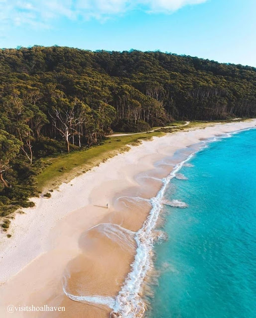
Jervis Bay is considered one of the most beautiful, large natural bays anywhere on the Australian coast. Officially maintained by the Australian Capital Territory, but many hours from Canberra, the expansive bay is lined with arguably Australia’s whitest sand and offers dependably safe swimming waters.
Like many other beaches, this region is held sacred by First Nations people and many still live and work within the area, Bouderee National Park is now under the management of its traditional custodians. Murray’s Beach has much to recommend over its Instagram famous and crowded neighbor of Hyams Beach. There is a modest daily fee to enter this part of the National Park but the visual reward at the end of the 300-meter walk-in is priceless. The water is usually calm here and family-friendly. Murray's Baech is also protected by Bowen Island, which the beach looks out upon over the wide Jervis Bay entrance channel. Nearby, you’ll find sea caves, a boat ramp, and peaceful bushwalking tracks.
DUNDEE BEACH
Location: Darwin, NT | Google Map
Dundee Beach, home to crocs, quite large ones, and yes, its name is derived from the popular film. While its red dirt and vast open spaces feel remote, Dundee Beach is ideal for a day trip or overnight camp up, as it’s only around 30-minutes southwest of Darwin. A nesting site for turtles means 4WD’ers must take extra care to drive well below the high tide mark. If your groove is a palm-fringed wild escape with fresh sea breezes and gorgeous sunsets over a cold beer, then this may suit your salted-travel diary. The small coastal hamlet boasts exceptional fishing, crabbing, birdwatching, a public boat ramp, organized fishing charters, a popular but low-key lodge, and regular beachfront markets. The surrounding area includes a diverse range of wildlife and habitats, from monsoon forests and savannah woodlands to mangroves, wetlands, and estuaries. You can explore the area via easy beach walks, rocky cliff climbs, and walking trails, but be sure to pack adequate water, a hat, and sunscreen.
DUDLEY BEACH
Location: Newcastle, NSW | Google Map
Only a few seasoned coastal insiders know of Dudley Beach, one of Newcastle’s best-kept secrets. But with its wide-open spaces, long golden beach, and verdant green foreshore, there’s plenty here to share. Tucked away between its better-known neighbors, Merewether and Redhead Beaches, here you can imagine you are miles from civilization while only 15minutes from central Newcastle. Dudley Beach provides a fantastic escape for walking, beachcombing, surfing, fishing, or simply exploring. Surrounded by the Glenrock and Awabakal Conservation Areas, it is buffered from development. Its peaceful walking tracks wind through some of the last protected remnants of coastal rainforest in the region. It’s also unpatrolled by lifeguards so take care. The area has just enjoyed a facelift with a new car park and picnic areas to take advantage of the glorious surroundings.
THOMPSONS BEACH
Location: Cobram, VIC | Google Map
Until recently, Australia’s beaches were always considered coastal. That all changed in 2020 when Wagga Wagga Beach made the Best Australian Beaches list first as a river ‘beach’ much to the surprise of salty purists. But the inclusion of inland beaches was met with a rapturous welcome from the many communities who cherish their watery relief in the often-parched, Australian interior. First Nations peoples have gathered at waterholes and rivers for over 60,000 years for recreation, despite the heat, seeking fish, shoreline resources, and relaxed refreshment. Thompson’s Beach has been chosen from the 100 or so beaches on the banks of the mighty Murray River for 2022. Here you can swim from the charming town of Cobram in northern Victoria, across some 50 meters at the river’s bend, and enter NSW. Claimed by locals to be Australia’s largest inland beach, it’s a tranquil setting amid towering red river gums, where koalas are often spotted along with the ambient sound of around 90 native bird species. It’s a paradise for swimming, fishing, walking, boating, canoeing, volleyball, beach cricket, and picture-perfect riverside picnics.
COOGEE BEACH
Location: Coogee, WA | Google Map
Just a few minutes' drives south from the fashionable café strip of historic Fremantle lie the ever-popular favorite Coogee Beach. While its Sydney sister beach of the same name is found 4000km to the east on the edge of our largest city, Freo’s Coogee Beach faces west over the gleaming Indian Ocean, where the sun sets into the sea, rather than rising over it. A 300metre eco shark barrier is just one of the numerous reasons this west coast gen attracts swimmers and beachgoers year-round. With Rottnest and Garden Islands hovering on the horizon, its iconic jetty, fun summer pontoons, grassy parklands, BBQs, and handy parking, Coogee attracts weekends crowds to its alluring swimming waters. There’s even a half-sunken shipwreck to explore, the Omeo, just 25 meters offshore, which came adrift from Fremantle port in 1905. Now part of the Coogee Maritime Trail, showcasing the rich seafaring history of the area, you are welcome to snorkel the wreck, but care the awareness of ocean conditions is required. And after a day at the beach, you won’t have to go far for good coffee, great food, and Freo’s many multi-cultural charms.
MOTS BEACH
Location: Marlo, VIC | Google Map
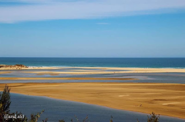
Mots Beach is where the legendary Snowy River meets the Great Southern Ocean, where the spring thaw sees molten snow from the Victorian Alps mix with the salty ocean in the heart of East Gippsland. The nearby village of Marlo provides a comfortable base for a weekend of exploring one of the most secluded and sublime beach escapes in Australia. The little seaside township swells from 300 locals to 3000 visitors during peak season, attracting your families and fisherfolks, chasing silver bream from the bountiful estuary. While swimming in the estuary is popular, the beach proper can be reached on low tide in knee-deep water. But plan your journey well according to tides and take note of local tips. Nearby Cape Conran is safer for an ocean swim. The historic Marlo Hotel perched on a hill overlooking the stunning coastal vista has been the place to yarn over a cold drink for over 120 years, while two caravan parks with cabins welcome overnight visitors. This is the traditional land of the Gunai Kurnai people, requiring respect for flora and fauna, particularly in the adjoining National Park.
ALEXANDRIA BAY
Location: Noosa Heads, Queensland | Google Map
One of 20 or so ‘free’ beaches in Australia, Alexandria Bay must rate among the finest ‘clothing-optional' beaches in the world. 150 km north of Brisbane, completely surrounded by national park, Alexandria Bay is nestled between the famous surfing pointbreaks of Noosa Heads and its bustling holiday town to the north and the popular Sunshine Beach to the south. Access is via a series of walking trails through Noosa National Park and spectators of its nude bathing scene are discouraged. While this is not officially designated as a clothing-optional beach, authorities have turned a blind eye for decades, and Alexandria Bay has an especially large LGBTQIA+ following. Noosa, a World Surfing Reserve, offers five square km of superb coastal and forest walking trails through the National Park. There are no amenities on the beach, and signs in the park advise swimmers to be cautious of the strong surf and rips.
EMU BAY
Location: Emu Bay, South Australia | Google Map
Australia’s third-largest island is blessed with pristine wilderness and wildlife, but it’s her 50 unique beaches that have modern-day explorers in raptures. Kangaroo Island’s hilly interior is surrounded by 540kms of varied coastline, from the wildly rugged and swell-battered south coast to the protected bays and coves of the northeast. Emu Bay on the north coast is the only beach with direct 4WD beach access and it’s only 13km from the main township of Kingscote. It’s the local’s favorite, beloved for its towering dunes, four km sweep of fine white beach, safe swimming waters, and quaint jetty, built-in 1918. You’ll need at least a few days to explore Kangaroo Island, or Karta Pintingga to its original inhabitants, which can be reached by car and passenger ferry at Cape Jervis, around 90-minutes south-west of Adelaide. It’s also worth visiting the colonial haunts of early sealers and pirates and learning about Kangaroo Island’s fascinating history.
LAKE WABBY, K'GARI
Location: Fraser Island, Queensland | Google Map
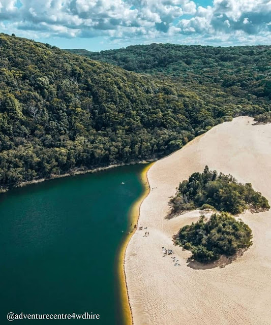
Fraser Island was recently rechristened K’gari (pronounced ‘Gari’) meaning ‘Paradise’ in First Nations’ Butchulla language. It is also a UN World Heritage site, as the world’s highest and largest sand island. While a wide variety of amazing beaches ring the entire 200km shoreline, it’s the unique rain and spring-fed lakes amid lush forest that have provided much respite from the wave-lashed coast for millennia. The backbone of K’gari supports more than 40 freshwater perched lakes, the most visited and easiest to access legendary Lake McKenzie. But crescent-shaped Lake Wabby is a close runner-up and the deepest at 11 meters. Its emerald, green waters hover at around 24 degrees Celsius year-round, an alluring oasis amid the sand dunes. These ephemeral lakes are gradually disappearing year by year, consumed by sand drift from the prevailing easterly winds. There are no amenities, so take out what you take in. K’gari can be reached by vehicle ferry from either Inskip Point or Hervey Bay. The island has been a magnet for anglers, campers, birdwatchers, and 4WD’ers for decades. Among the unique wildlife are the ever-present, pure, and protected Australian dingo, which must be observed from a distance and not approached.
CONGWONG BEACH
Location: New South Wales | Google Map
It looks inviting from the air, but even more so if you’ve found yourself at Sydney airport with a few hours to spare and in need of a brief refreshing dip or a dose of nature. Welcome to Congwong Beach, less than 15-minutes by car from the airport, and 25-minutes from the CBD. While there is a selection of other beaches in the southern Sydney urban vicinity, this south-facing gem is the cleanest, most family-friendly, and less crowded, especially during the week. Situated within the beautiful Kamay Botany Bay National Park, it is easy to reach from Cann Park in La Perouse via a 100-meter stepped pathway to its calm shoreline. It’s an ideal place to lounge away from the frenzy of its urban setting at the entrance of Botany Bay. There are delightful bush tracks to explore. One which leads east to the adjoining Little Congwong Beach, the much visited and unofficial ‘clothing optional’ beach of sublime beauty. There are spectacular views and a short walk that brings you to Bare Island Fort, the location for the Hollywood film Mission Impossible. If you have more time, bring snorkeling gear or a fishing rod. Over 30 Aboriginal sites have been recorded in this National Park, including rock art and engravings.
JELLY BEAN POOL
Location: Blue Mountains, NSW | Google Map
As much fun for kids, old and young, as a bag of jellybeans and shaped like one, this waterhole is known as one of the top swimming spots in the wilderness of the Blue Mountains National Park. No longer a well-guarded secret, at the peak of summer its wide sandy beach can feel more like the Bondi, with throngs of day-trippers and locals, or more seclusion can be found at nearby Blue Pool or Glenbrook Gorge. Early mornings and late afternoons, or the cooler months outside of summer, are the best times to enjoy this pristine location in greater serenity. Opening hours are 8:30am to 7pm during daylight savings and 8:30am to 6:00pm for the rest of the year. Jelly Bean Pool is accessed by a short but steep 200-meter path from the car park and it costs $8 per car to enter. The many delights of the Blue Mountains, walking trails a scenic lookouts make it a beach excursion with a difference.
ETHEL BEACH
Location: Christmas Island | Google Map
Straight from the pages of Robinsons Crusoe, Ethel Beach is a beach goer’s delight set deep in the Indian Ocean, closer to Indonesia than Australia. This far-flung Australian Indian Ocean Territory is dominated by an unspoiled National Park and is famous for its migrating red crabs. With 11 beaches, it’s an oasis of dense green jungles amid the great blue depths, brimming with marine life. While many associate Christmas Island with its Detention Centre, its natural assets are perhaps less well-known. Ethel Beach is fringed by dense, over-hanging, tropical foliage and strewn with coral, its clear tropical waters ideal for snorkeling or swimming. A boat ramp leads from the car park down to the beach and a freshwater shower allows you to rinse off after a dip. Bring a snorkel and mask or a picnic lunch and be prepared to share the beach with curious crabs, not crowds. On the same triangular flight route from Perth are the superb Cocos-Keeling Islands, where you’ll find tropical Cossies Beach, named Best Australian Beach in 2018.














Post a Comment