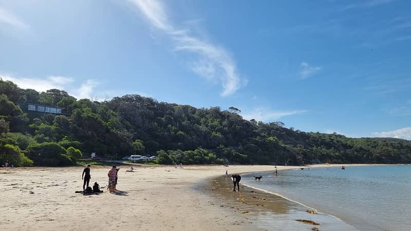
The approach to Walkerville from the north via the Fish Creek Road passes through lush and undulating pastoral land and ends up at the Promontory View housing estate. At this point, following the no through Bayside Drive along the coast for a couple of kilometers takes visitors past the local caravan park and to Walkerville North. Alternatively, the inland route makes an almost 10-kilometer semi-circle around this section of the Cape Liptrap Coastal Park, rejoining the coast at Walkerville South and then terminating partway along the coast at the boat ramp. The two dead-end coastal roads at Walkerville North and Walkerville South are linked by an 800-meter walking track called the Limeburners Walk which traverses the cliff tops and offers spectacular views along the pristine coastline. Alternatively, walking between the two road endpoints can be done along the sandy beach with its characteristic rock formations and native bush backdrop.
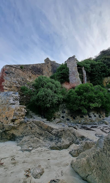 |
| Remains of Walkerville’s old kilns. |
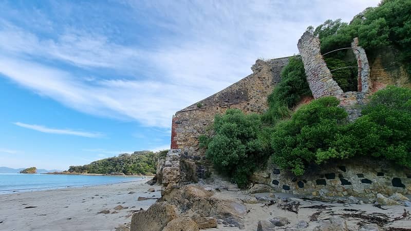
In the late 1800s limestone to make slaked lime was needed as a mortar for building with stone and brick in the rapidly growing Melbourne. The discovery of limestone full of calcite just above the sheltered cove of Walkerville South was ideal for this purpose. From 1870 to 1929 limestone was fired into slaked lime on the cliff face and transported in bags to Melbourne and Geelong. Many of the wharf pylons were still visible as recently as a few years back. A worker’s settlement here at one stage housed 80 workers and their families.
The stone was transported from the cliffside by horse-drawn carriages/ trollies on rails. It was stacked into kilns between layers of wood; two of the kilns are still visible on the cliff face after much restoration work, despite vulnerability to the salt spray and weather generally. The kiln was then covered and fired – the resulting slaked lime was then bagged. Display boards included photographs of the kilns in working condition and of the village.
The limestone cliffs around Walkerville were actively mined until 1926. A relic of the lime burning process can be found along the foreshore between Walkerville North and South at one of the kilns which have been preserved.
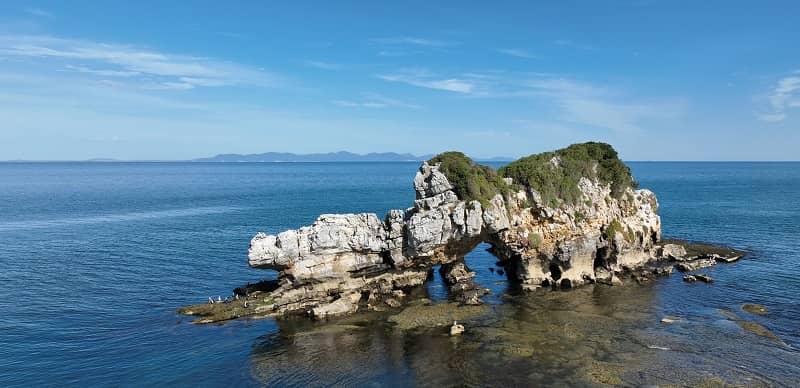
Despite having few local services, Walkerville has developed into a destination for those seeking a quiet, relaxing day trip or holiday. There are good views of the mountain ranges at Wilsons Promontory from the safe swimming beaches and scenic fishing spots which front Waratah Bay and there are several interesting rock formations just off the coast, including Arch Rock and Bird Rock.
As of the 2021 Census, Walkerville’s total population is around 130, with an average median age of 57 years old.
Bird Rock
Bird Rock is a series of jagged sandstone and shale bluffs, sea stacks, rocks, and reefs that extend 1 km seaward from Walkerville. Tucked in on either side of Bird Rock are two small beaches. The northern beach faces north and is well protected from large swell, with waves averaging less than 0.5 m. The narrow, 60-meter-long beach has a shallow bar with large rocks and boulders on the beach and in the surf. The beach on the southern side faces southeast and, being more exposed, receives waves averaging 1 m. These waves weave in amongst the rocks and sand to scour both rips and scour holes. Both beaches are accessible on foot from Walkerville, via the rocks at low tide, or along a bluff-top walking track.
Swimming is safe at the northern beach; however, rocks dominate the low tide area. The southern beach is very hazardous even with low waves, owing to all the rocks and reef, and should be avoided. Fishing is best on the southern beach, where there are many vantage points to fish the numerous holes and gutters. No surfing.
Cape Liptrap Coastal Park
Stretching along the coast from the sand barrier of Point Smythe to the sheltered waters of Waratah Bay, around 10 kilometers southwest of Walkerville, is Cape Liptrap Coastal Park has strikingly beautiful scenery. With Cambrian rocks and recent sands, the occurrence of about 270 species of flowering plants including 27 orchids, as well as supporting threatened flora and fauna species.
The coastal park transforms from being a peaceful coastal area to wild, windy, and awe-inspiring in stormy weather. Whatever the season, Cape Liptrap Coastal Park is worth exploring.
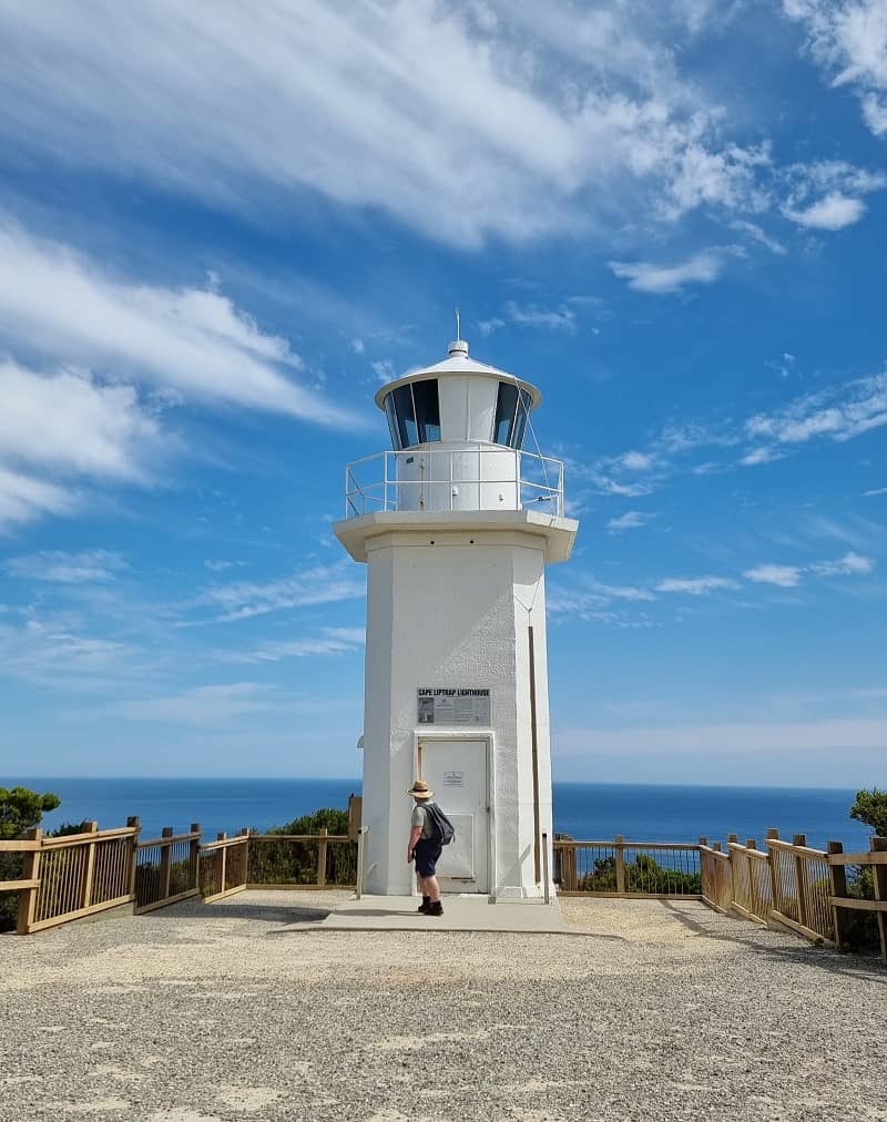
A 10-meter-high lighthouse was established at Cape Liptrap in 1913 to improve the safety of coastal shipping. In 1951 the steel tower was dismantled and replaced with the current structure. The light is still in operation and has a range of 18 nautical miles (over 34 kilometers).
Things to see and do in Cape Liptrap
Enjoy walking!
• Point Smythe Walk - 6km, 1-hour one way
This circuit you through thick coastal vegetation leading to the beach at Point Smythe. The track is particularly sheltered on windy days.
• Bald Hills Wetland Walk - 750 meters, 15 minutes one way
A meandering track leads you through a series of sand ridges and thickets of Paperbark to a sheltered bird hide where you can sit quietly and observe birds feeding within the wetland.
• Cape Liptrap Lighthouse Walk – 300 meters, 5 minutes one way
Take a short walk with breathtaking ocean views to the Cape Liptrap Lighthouse.
Established in 1913, the light remains in operation today and has a range of 18 nautical miles (over 34 kilometers).
• Lime Burners Walk – 750 meters, 15 minutes one way
This track links the north and south settlements of Walkerville through stands of drooping She-oaks, past cliffs, and the ruins of lime kilns. A short sidetrack leads to the Walkerville Historic Cemetery.
• Overlook Track Walk – 1.2km, 45 minutes one way
This track links the Prom Views Estate with the Walkerville North Caravan Park. A side track of 700 meters, leads to a viewing platform overlooking Waratah Bay and the peaks of Wilsons Promontory National Park.
Walk with your dogs!
Dogs are permitted in the following areas of Cape Liptrap Coastal Park:
• Between Walkerville North and Walkerville South
• Between Venus Bay Number 1 and Number 5 beaches
• Between Waratah Bay township and Cooks Creek
Dogs are required to be always on a leash and are prohibited from these areas between 9am – 6pm from 1st December until 31st March. These measures protect the Hooded Plovers; a ground-nesting bird listed as vulnerable. Dogs are prohibited in all other areas of Cape Liptrap Coastal Park.
Horse Riding
Horse riding is permitted within the park on the intertidal area of the beach below the highwater mark, between the ocean outfall pipeline of Venus Bay and Arch Rock. Riding is only permitted below the highwater mark to protect the Hooded Plover habitat. Access to the beach is via the Five Mile Track, however, this track is not open for vehicular access due to its unmaintained condition.
Camping
Bush camping is provided at Bear Gully on the shore of Waratah Bay. Advanced bookings and payments are required – visit https://www.parks.vic.gov.au. Dispersed camping is also permitted within Cape Liptrap Coastal Park.
Swimming
Venus Bay Number 1 Beach is patrolled by surf lifesavers surfing on selective dates in summer months, which are subject to change. Swimmers must be cautious as strong currents and rips occur along this section of the coastline.
Fishing and Boating
Recreational line fishing is popular throughout the park, both from the shore and by boat. A Recreational Fishing License (RFL) is required to take fish (including bait and shellfish) in all Victorian marine, estuary, and freshwaters. Please visit the Victorian Fisheries Authority website – www.vfa.vic.gov.au for more details and information on RFL exemptions and license requirements.
Accommodations available at Walkerville VIC
Bear Gully Coastal Cottages
Address: 35 Maitland Court, Walkerville South 3956, VIC
Phone: 0439 595 212
Website: https://www.beargullycottages.com.au/
Spindrift Walkerville
Address: 104 Bayside Drive, Walkerville North 3956, VIC
Beekeepers Sanctuary
Address: 350 Cape Liptrap Road, Tarwin Lower 3956, VIC
Phone: 0422 818 809
Website: https://www.beekeepers.life/
Wirrega
Address: 460 Bear Gully Road, Walkerville South 3956, VIC
Phone: 0427 331 825
Website: https://www.wirrega.com.au/
Shellback Holiday House
Address: 265 Cape Liptrap Road, Walkerville 3956, VIC
Phone: 0428 688 263
Website: https://www.dufflebird.com.au/en/1061375/shellback
Magic Beach House
Address: 3 Casuarina Grove, Walkerville South 3956 VIC
Phone: 1300 131129
Website: https://getawaypm.com.au/accommodation/getawaypm-eye-of-the-sea/
Shearwater Beach House
Address: 39 Acacia Road, Walkerville 3956 VIC
Phone: 0428 688 263
Website: https://www.dufflebird.com.au/en/787177/shearwater-beach-house
Jandi Holiday House
Address: 83 Grevillia Street, Walkerville 3956 VIC
Phone: 0433 718 636
Website: https://jandiholiday.com/
Liptrap Loft
Address: 16 McBurnie and Boags Road, Walkerville 3956 VIC
Phone: 0428 688 263
Website: https://www.dufflebird.com.au/en/787172/liptrap-loft
Waratah Bay Caravan Park
Address: 11 Freycinet Street, Waratah Bay 3959 VIC
Phone: (03) 5684 1339
Website: https://waratahbaycaravanpark.com.au/
Prom Coast Holiday Lodge
Address: 1075 Waratah Road, Waratah North 3959 VIC
Phone: (03) 5684 1110
Website: https://www.promcoastholidaylodge.com.au/
Sunset Deck Beach House
Address: 12 Telopea Drive, Sandy Point 3959 VIC
Phone: (03) 5684 1111
Website: https://www.sunsetdeckbeachhouse.com/
Sandy Point Gallery Cottage
Address: 34 The Boulevard, Sandy Point 3959 VIC
Phone: 0439 725 328
Website: http://www.sandypointgallery.com.au/
Sandy Point Beach Escape
Address: 1 Ryans Rise, Sandy Point 3959 VIC
Phone: 0414 603 662
Website: https://www.visitgippsland.com.au/accommodation/www.spbe.com.au
Driftwood Villas
Address: 257 Sandy Point Road, Sandy Point 3959 VIC
Phone: 0429 031 045
Website: https://driftwoodvillas.com.au/









What a Beautiful Scenery, i Loved this Place, so Gorgeous and Perfect place this Summer Season.
ReplyDelete